Case Study
Technical assistance, development, and implementation of a Spatial Data Infrastructure (SDI) as part of Angola's National Geology Plan (PLANAGEO)
Client
PLANAGEO
Services
-
Industry
Mineral Resources, Oil and Gas
Context
The project is part of Angola's strategy to diversify its economy, reducing its dependency on the oil sector by strengthening the non-oil extractive industry. To achieve this, the goal is to equip the Geological Institute of Angola (IGEO) with advanced capabilities to characterize the country's mineral resources.
The main objective is to develop a Spatial Data Infrastructure (SDI) that integrates geoscientific data and associated services, improving the knowledge and management of mineral resource information. This is key to attracting investments that drive sustainable and efficient exploitation of the mining sector.


Challenge
Regarding the challenges, the following stand out:
Building from scratch
The primary challenge faced by the client was the creation from scratch of a set of data models, as well as the development of the geological database (BADAGEO) and various information systems for its use and analysis. This process was critical to addressing the lack of spatial data infrastructure and the limited access to organized information on Angola's mineral resources.
Current context
Addressing these challenges was essential in the current context, as precise and detailed knowledge of the country's mineral wealth is key to attracting the investment needed for its exploitation. This directly contributes to diversifying Angola's economy, reducing its strong dependency on the oil sector.

Solution
The implemented solution combined GIS and project management capabilities of SATEC with the field expertise of Miapia Surveys, an Angolan company and SATEC partner, and the German laboratory MicroPro, specialized in microbiological and geochemical analysis.
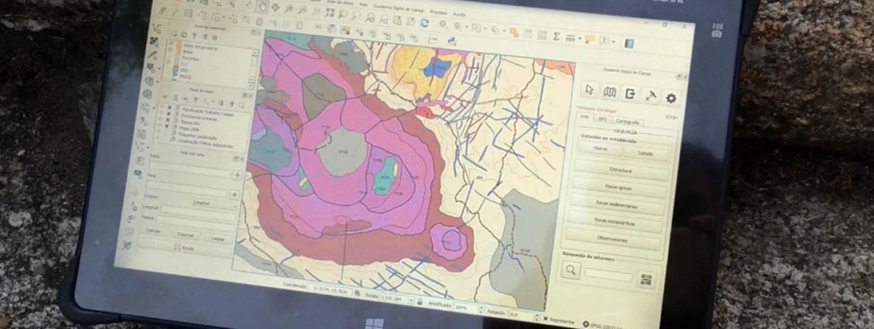
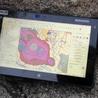
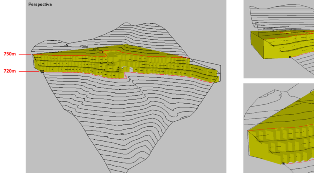
To address the identified challenges, the BADAGEO database was implemented, consisting of three components to integrate vector information, documents, and files, providing a robust solution for managing geoscientific data. The Spatial Data Infrastructure (SDI) information systems were built based on open standards, aligned with the European Union's INSPIRE directive, and utilized open-source technologies, ensuring flexibility and sustainability.
This methodology was chosen for its cost-benefit ratio, allowing for a significant reduction in exploration areas through microbiological and geochemical techniques without excessive costs. SATEC excelled by providing comprehensive management of the planning, sampling, analysis, and results process, effectively coordinating with other contractors and employing the microbiological MPOG technique patented by MicroPro. Despite challenges encountered during development, smooth collaboration enabled the project to be nearly completed.
Results
The implementation of the solution for the Geological Institute of Angola (IGEO) has generated a series of key benefits for the extractive industry and the country's economy. The five most relevant benefits are highlighted below, promoting mining investment, geoscientific data management efficiency, and institutional strengthening:
Economic diversification
Reduction of dependency on the oil sector through the development of a more robust and attractive mining industry.
Attraction of investments
Increased promotion and capture of investments thanks to improved management and access to information about mineral resources.
Technological sovereignty
Implementation of open-source technologies and open standards, ensuring independence from external providers.
Innovation and leadership
Creation of a pioneering SDI in Africa, consolidating IGEO as a leader in geoscientific data management.
Transparency and accessibility
Improved access to critical information, fostering greater transparency in mineral resource management.